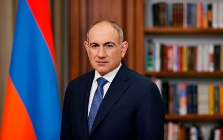
“Today, the territory of Armenia is 28,900 square kilometers, about a thousand square kilometers less than it should be,” said Hrant Bagratyan, former Prime Minister of Armenia and leader of the Freedom Party during a recent rally on France Square, where he spoke in detail about the demarcation process and the topic of enclaves, about which, after the 44-day war, they speak quite intensively and willingly. Assessing the losses of Armenia and Artsakh after the 44-day war, Hrant Bagratyan stated that when Nikol Pashinyan came to power, he accepted a country of 43,700 square kilometers, of which 31,400 square kilometers and 2,900 square kilometers from Artsakh are currently under Armenian control.
According to Hrant Bagratyan, in addition to the 42,000 kilometers conquered by Azerbaijan, we have voluntarily given another 340 square kilometers. He presented the territories of the Republic of Armenia as of 1920-2022. “As of 1918-1920, the Armenians controlled 53 thousand square kilometers. According to the Treaty of the Sevres, Armenia was to be 169,000 square kilometers. But the Armenians were fighting to the death to settle in the areas where they were to settle until August 10, 1920.”
Making a historical excursion, Hrant Bagratyan announced that the execution of the arbitral award was assigned to Woodrow Wilson, who did not hit “finger to finger.” “Know this once and for all, because it is often said that the West will come tomorrow, it will do better than Russia… I, for example, am a pro-Armenian, but the West will definitely not do better than Russia. I do not know how well Russia will do: it will do well as long as the Armenians stand firm on their land. It is not that the Russians will come and say, dear, we will solve your problems. Tomorrow or the next day we will take power, we will keep telling you that it is difficult. In order to be helped, you must be worthy of help. This is the order of the world.”
Demonstrated by Hrant Bagratyan on maps from 1918, Zangezur, the Republic of Nagorno-Karabakh, and Artsakh were not part of the Republic of Armenia. Nzhdeh was in Zangezur with his army and Andranik was in Artsakh. Both of them were fighting against Azerbaijan, which with its policy of ethnic cleansing wanted to clear the territory of Armenians and appropriate it, but instead, the Republic of Armenia controlled Surmalu, Kars, etc.- 32 thousand square kilometers. He then presented the battles of 1920-21, as a result of which Armenia lost and Karabakh was handed over to Azerbaijan as an autonomous region, and Alexander Myasnikyan saved the Republic of Armenia at the cost of his life, as the situation was such that the existence of the Republic of Armenia within the federation was not envisaged. Hrant Bagratyan also spoke about the situation in 1926.
Read also
“The important thing here is that there is Armenia – about 30,500 square kilometers – and the Nagorno-Karabakh Autonomous Region – about 6,000 square kilometers in the territory of Azerbaijan. In the south, the Nagorno-Karabakh Autonomous Region and Armenia were connected by the Lachin corridor from Lachin to Hadrut. There was no enclave here. Artsvashen was completely connected to the Tavush region. There is no Kyarki, there is no Barkhudarlu, there is no Nerkin Askepara.”
In the summer of 1926, an assassination attempt was made on Alexander Myasnikyan, who was killed in a plane crash. As early as 1928, the Trans-Caucasian Federation separated Artsvashen from the northeast of Sevan, but maintained a corridor with Armenia. At that time, about 370 square kilometers were given to Azerbaijan. Azerbaijan is also trying to “get stuck” in the territory of Armenia near Jermuk-Kapan, and these points are very strategic for Azerbaijan. Already in 1938, near Kapan, above Jermuk, Azerbaijan managed to “get stuck” in the territory of Armenia as a result of the construction of the Kapan-Minjan railway.
Bagratyan spoke in detail about handing over Nakhichevan to Azerbaijan, then Tigranashen, also known by its Azerbaijani name of Kyarki, cutting it off, cutting off Shahumyan and Aghdam in Artsakh, noting that they create such a situation that it is impossible to go North-South in Armenia or Artsakh.
Then, Bagratyan detailed the history of the construction of the Goris-Kapan-Chakaten road in 1961, noting that this is the road that Nikol Pashinyan handed over on December 18, 2020 with “Vagharshak Harutyunyan’s insidious signature.” He wondered how the Council of Ministers of the Armenian SSR at that time could allocate land to Azerbaijan and asked, “What should we do with Vagharshak Harutyunyan, who, out of fear, gives 42 km to the Azerbaijanis?”
Moreover, he noticed that according to the maps from 1961, not only did that road belong to Armenia, but also a huge part to the left of Goris. Then, he showed maps, on which the passages were separated, which until 1985. Azerbaijan has “squeezed” from Armenia and there is no evidence about them, except for the maps published in Azerbaijan. He also noted that even in those “tangled” territories there are no sections that Nikol Pashinyan handed over after 2020: the Sotk-Khoznavar section, the concessions in the Lake Sev region, the Goris-Kapan-Chakaten section.
“We went deep enough to find the maps of Azerbaijan until 1975, the history textbooks of Azerbaijan in 1972, according to which it was Armenian to the right of the Kur. But time passes, and they change the names, making them Azerbaijani,” Bagratyan said, calling what happened a normal Turkish expansion.
Nelly GRIGORYAN


