


Public and mostly opposition figures have recently raised the question on under-performance of capital expenses quite often. Given their status, their arguments are based on the lack of experience in public administration on behalf of government officials, while the authorities most often refer this to the corruption that previously ruled, and the problems that were present during internal discussions in state procurement and civil service systems.
In fact, all the above mentioned have their share in this matter and today we, the decision makers, attempt to find the middle ground in terms of delivering corruption-less quality work, at the same time ensuring their purposefulness.
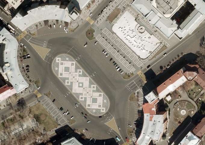
In regards to the procurement and realization process of Cadaster Committee entrances, it seemed that things would go smoothly for me, given my profession, while in fact we never managed to reach an acceptable result in this process which lasts over 9 months already. Moreover, we are far from getting close to this threshold.
The lack of public administration experience certainly has its positive sides; first of all it comes to exclude the shadow schemes within the existing system, as well as promotes critical approach towards the activities of this very public administration body and proposes substantial reforms.
Read also

")

And this is the logic that today prevails in the discussions of reforms in public procurement package mainly, which should at least address the existing problems.
In this process, however, I think we are omitting another crucial gap, which, is the most serious gap in the post-independence period, and I assume in post-Soviet period as well; quite often we do not possess accurate data for making apposite decisions. As I have already mentioned several times in the past, the country was previously ruled “in an approximate manner”, especially in fields such as construction and generally in areas that have physical (spatial) components – from road construction to environmental protection, from agriculture to water management.
Unfortunately, we still lack proper spatial data on our lands, roads, public buildings, agricultural parcels among many other important sectoral components.
Proper resources have never been invested in these fields previously, for different reasons, firstly given the general public administration focus, since public administration used to be a continuation of electoral processes, the investment for received votes or those to still be received.
We should keep in minds that the data, apart from contributing to decision making, is also a serious supervising tool, and its existence and accessibility could in fact cause serious problems for officials at different levels. Similar to the past, we can still tell (by making a phone call or viewing several lists) how many X type buildings there are at a certain territory, and can of course provide data on their workload, although in terms of systematization of those data and in terms of obtaining those simultaneously, I am sure for most of the cases we do lack a proper and coordinated database.
Naturally, prior to being appointed to the Head of the Cadastre Committee I knew exactly that we are facing this serious challenge, moreover, it would take us several years to gather all these data. Nonetheless, similar to last year, today the day-to-day work of our team (in addition to serving daily needs of our citizens and public bodies) is mainly aimed at the creation of a modern system for collection, classification, storing and sharing of proper spatial data for the entire territory of Armenia, in a long-term perspective. This is what we call an Integrated Cadastre. For the time being we do anticipate the Integrated Cadastre shall partly operate in a few years and store spatial data in a scientifically – sound logic.
But will the creation of this system let us have a functional and proper system for decision making? Well, by all means, we shall approach a decision making based on incomparably accurate data, but will this come to change the quality and speed of our decisions? I think, as a result of spatial data collection, we should highlight its subsequent level – the spatial planning, which used to and is still sometimes called urban planning.
I do not intend to touch upon the disputable disciplinary or professional terminology issues of urban planning, which I happened to deal with in the past, I consider it important to state that spatial planning is the exact tool through which representatives of different fields, can and must reflect spatial development visions (in time and space) pertinent to special inclusion areas, which will refer to transport organization, preservation of cultural and natural landscape, urban development, improvement of tourism infrastructures, distribution of educational and healthcare institutions, as well as to the elaboration of areal sub-policies based on various disciplines.
By the way, this is not a new invention. This is a process based on experience and logic exercised in many developing and developed countries, which actively involves specialists of spatial planning (urban planners, economists, sociologists among many others), who draft such documents, thus providing ready-made, developed concepts and ideas to the managers of different levels of public administration that include settlements, communities, regions, marzes (provinces) and other territorial units.
This means, if a certain settlement possesses its proper spatial planning documents, the given community head and the city council already obtain a 20-25 year development strategy, and by simply relying on this strategy they can foresee long-term community development projects given financial flows. The emphasis on spatial planning should not create the impression that it shall only serve as predication to the public administration bodies only; it should first of all serve citizens and enterprises.
I was recently briefed with a case when a citizen happened to obtain a land in a territory with built houses that were surrounded by houses with their own yards, and went ahead by building a house himself, with a pool and a yard. Several years later another person received permission to build a multi-storey residential building in the same neighborhood, which became completely pointless to the first house owner’s intention of having isolation at his house, let alone the second owner’s expensive purchase.
In another case an investor planned to purchase a huge piece of land for the purpose of building a multi-apartment residential building complex, and for the business plan estimations, he considered it necessary to find out the building permits (number of stories, density) allowed for this particular zone. If in the second case I could suggest discussing this issue with corresponding representative from respective municipality, the first case is truly irreversible, well unless the first house owner would decide to appeal community decision in the court, which is indeed a lengthy procedure and you never know whether he would reach any tangible results. On the other hand, receiving a prior agreement from city could be quite risky, since the city representative might be replaced by another one, or he could change his decision eventually. The key to this case and to other cases in general, is having a complete and open spatial planning system.
Proper spatial planning documents or zoning plans on local levels should immediately become the main guiding and legal documents for every urban and major rural settlements, otherwise we shall keep on making subjective and arbitrary decisions, which previously used to be “filtered” within the logic of corruption or semi criminal-decision making paperwork, but today those decisions have the potential to become more massive and dangerous, since they refer to everyone.
Should we add to that Cadastre Committee records an increased demand in the real estate market, we shall end up facing serious challenges at least in Yerevan and its agglomerates. Naturally in the 21st century and especially in 2018 – post-revolutionary Armenia, it is needless to mention those documents should be drafted in an inclusive way – through re-evaluating public awareness and hearing instruments. This is the only way to make its main beneficiaries become part of this process and the carriers of those ideas.
Well, it would be naïve to think that spatial planning documents alone could solve the bundle of problems within construction and other permissions encapsulated in urban planning in general, yet I still think that spatial planning is the key “gear wheel” for public administration, which (if applied correctly) can make other “gear wheels” function effectively.
These are the “gear wheels” that should control the economic revolution turbine announced by the government, ensuring its sustainability and institutionalization, by reducing administrative intervention on behalf of state officials.
The thing that all the above mentioned can be realized in the near future, forces us to revalue the investments we have made in the collection and planning processes of spatial data. International practice has proved that this is ten times more effective than “approximate” or “roughly estimated” planning.
Sarhat Petrosyan,
architect, urban-planner, urbanlab founder
“Aravot” daily
